About SurvTech Solutions, Inc.
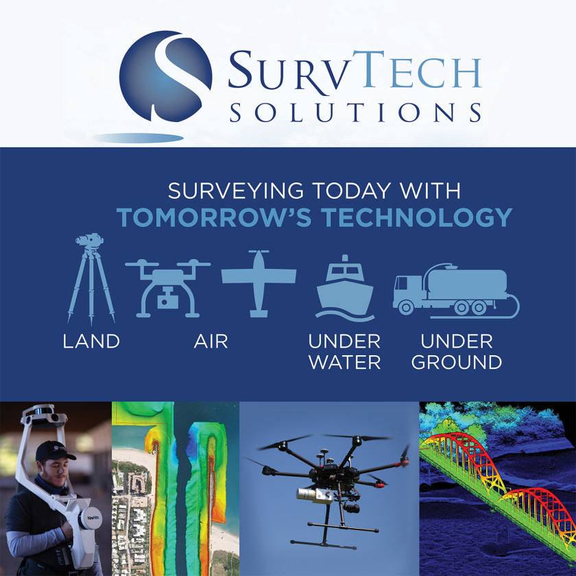
Services include conventional land surveying; hydrographic surveying (single beam, multi beam, side scan, sub-bottom, and interferometric); subsurface utility mapping (GPR, ERI & EM), including soft dig capability (vacuum excavation); 3D high definition laser scanning (terrestrial LiDAR), mobile LiDAR, Indoor Mobile LiDAR and 3D modeling and BIM services; Metrology and Laser Tracking (Industrial Equipment alignment); geophysical mapping (GPR, E RI, EM, and Seismic); Geographic Information Systems (GIS); and aerial mapping utilizing unmanned aerial vehicles (UAV's or drones) and fixed wing airplanes. The SurvTech team offers a turnkey solution for mapping on land, on water, under water, underground (on land or underwater) or from the air, with one manned and unmanned systems!
Location & Directions for SurvTech Solutions, Inc.

Services SurvTech Solutions, Inc. Offers
-3D Laser Scanning
-Land Surveying
-Aerial LiDAR & Imagery
-Unmanned Aerial Surveying
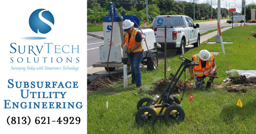
-Subsurface Utility Mapping (SUE)
-Geophysical Mapping
-Hydrographic Surveying
-Interior Mobile Scanning
-Mobile LiDAR
-UAV's - Drones
-Concrete Scanning
-Ground Penetrating Radar (GPR)
-UAV
-Metrology
-Digital Twins
Reviews For SurvTech Solutions, Inc.
Reviews for this business have been aggregated from multiple sources.Based on 0 Reviews
Add ReviewMore About SurvTech Solutions, Inc.
SurvTech Solutions is a premier commercial geospatial and surveyor firm based in Tampa, Florida. We use the latest technology to get superior results throughout Southeastern United States. Services include Land Surveys, Aerial LiDAR, Hydrographic Surveys, Drone Surveys, Subsurface Utility Mapping, and 3D laser scanning.
Survey Offices based in or near:
• Tampa, Florida
• Sanford, Florida
• Fort Pierce, Florida
• Fort Myers, Florida
• Jacksonville, Florida
• Mulberry, Florida
• Covington, Louisiana
• Mobile, Alabama
• Decatur, Alabama
• Burham, Maine
• Puerto Rico
Licensed to Survey in these states:
• Alabama
• Arkansas
• Colorado
• Florida
• Georgia
• Kentucky
• Louisiana
• Maine
• Mississippi
• North Carolina
• Puerto Rico
• South Carolina
• Tennessee
• Texas
SurvTech Solutions, Inc. Gallery

- Business Details Unverified
-
10220 E Us Highway 92
Tampa, FL 33610 - (813) 621-4929
- No. of Employees 100
- No. of Locations 10
- Year Founded 2004
-
![IRI Incorporated]() IRI Incorporated
IRI Incorporated
0.0 No Ratings - More Land Surveying listings